Risk analysis of the Alto Garda area by means of microzonation and structural characterisation of buildings mapping


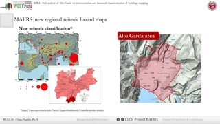 New regional seismic classification and the Alto Garda study area (from the presentation)
A reliable seismic risk assessment at national and regional scales has become a major focus for researchers and practitioners, as well as decision-makers and territorial stakeholders. The two primary components of risk assessment, i.e., hazard models and vulnerability analysis, have been the subject of extensive study. In fact, they play a critical role in improving risk management strategies, planning infrastructure and engineering facilities, and supporting disaster response management at a regional scale. Within this framework, a detailed regional risk assessment for the Trentino Alto Garda region, in northern Italy, is presented herein. The recently completed microzonation of the studied area is considered for the hazard analysis contributing to improving the assessment at the local scale and with high spatial resolution. Additionally, data mining of structural building information databases and statistical models of the building asset that take advantage of the main building characteristics evaluated by means of seismic noise measurements and analysis, are used to develop exposure maps. As a result, the hazard and exposure maps are integrated to derive a first semiquantitative seismic risk assessment for the case study area.
Click the Cite button above to copy .bib publication metadata into your notes. or directly download here either the bibtex version: Download BibTeX or the plain text one: Download Plain.txt

